It was a beautiful day in Isafjordur. The clouds from last night had disappeared, the sun was out, the sky was blue and the flowers were blooming. I was in no hurry to leave, and spent all morning strolling around the area.

I headed out around noon, and was going to spend the day just driving along Rte60 down the west coast of the fjords, stopping multiple times along the way ofcourse.
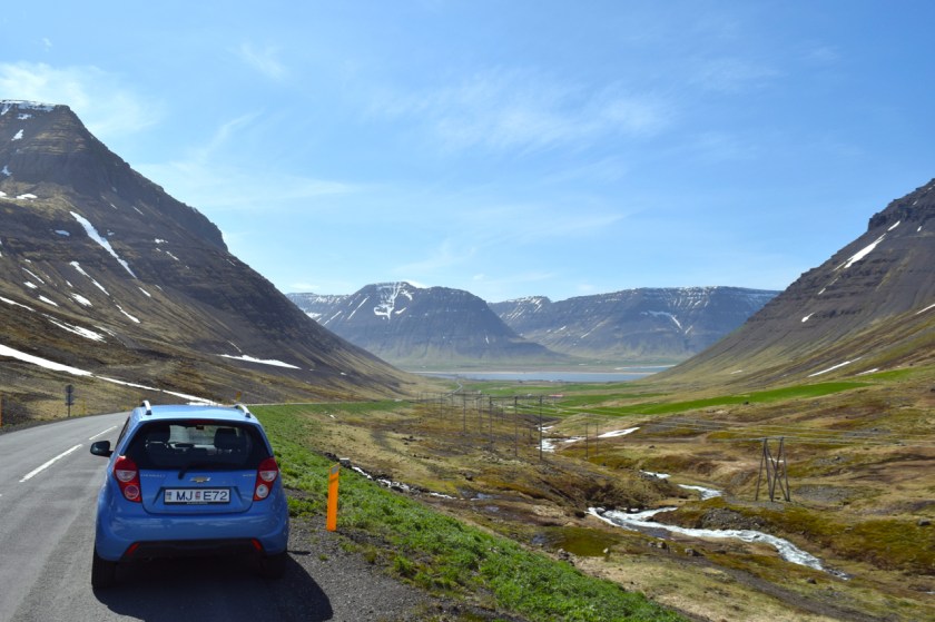
I don’t really know how I spent my time in the car. I think I was so transfixed by my surroundings, I drove through in a daze of sorts. At some point, I had to stop to make sure I still was on Rte60 and had not drifted off onto some other road. The whole place was mesmerizing.
Pictures don’t do this place much justice. It isn’t just about the way it looks, it’s the whole energy of the place. It feels humbling, euphoric and calm all at once.
I snapped out of my daze as I approached a turnoff for Dynjandifoss, the crown-jewel of waterfalls in the West Fjords.
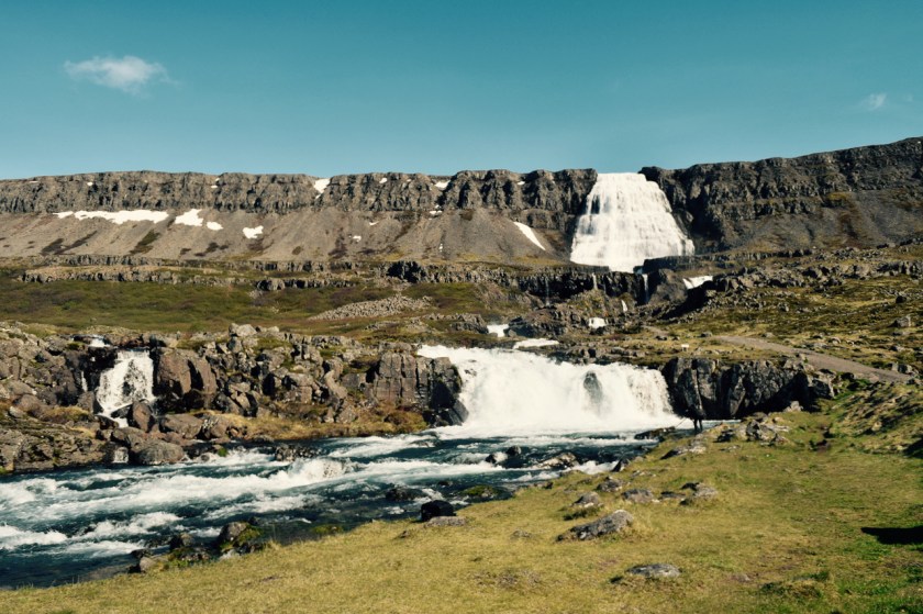
It was nice, but no cigar. Maybe I have seen too many waterfalls in the last little while to really appreciate them anymore. Nonetheless, it was worth a hike to the top and a chance to stretch my legs out.
Great view! I was the only guy up at the top of the falls who wasn’t looking at the falls.
I hiked back down and stopped to cook lunch.
I noticed a lot of people who came to visit the falls were very preoccupied with taking pictures. They would barely pause to watch, enjoy and experience the place, instead spending their time adjusting their tripod or selfie-sticks to get the perfect shot. I guess they’ll appreciate it in the pictures they took at some point in the future…
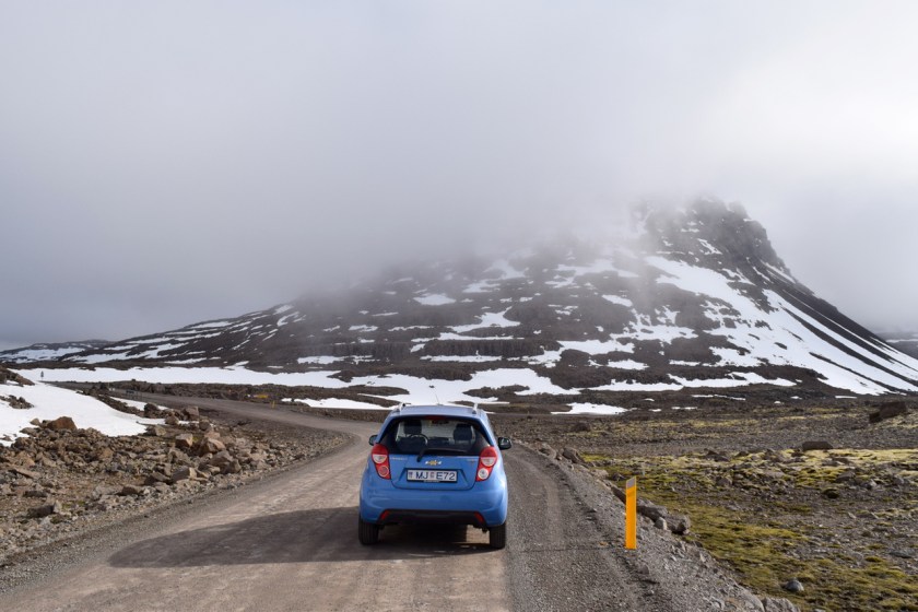
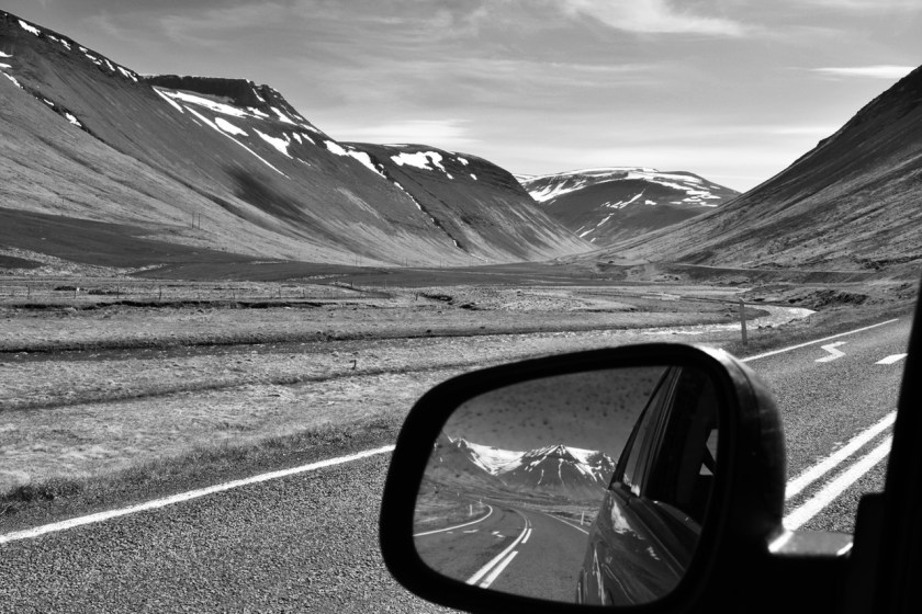
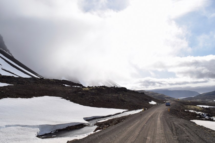
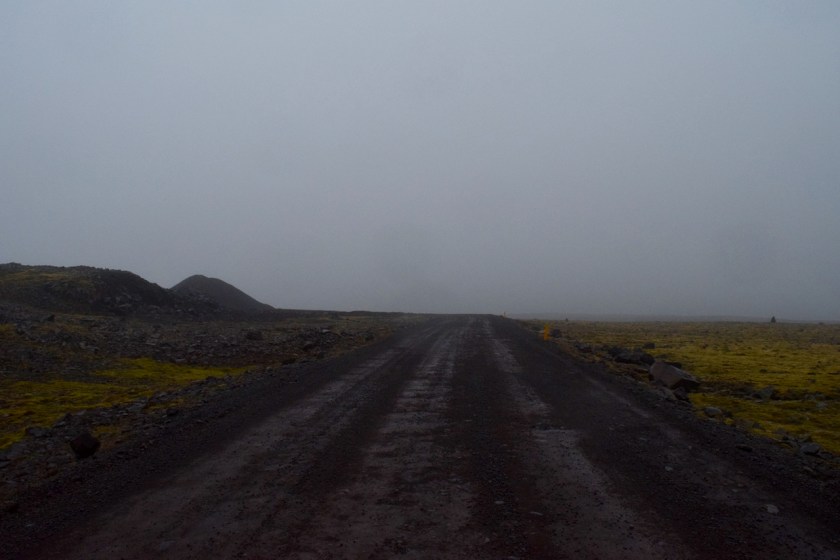
The road got gravely after a while. I started gaining altitude and found myself driving right into a cloud. The day had started off with blue skies, but I had been warned that the weather in the West Fjords changed at the drop of a hat.
Apart from bad roads and clouds looming overhead, I also had the added threat of sea monsters.
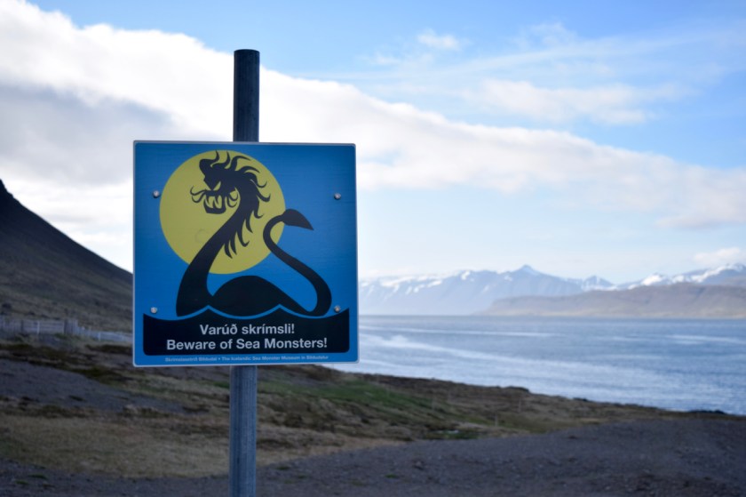
Iceland is a superstitious country, and who can blame them? The country has a magical landscape, and it lends a great setting for the folktales. There are stories of troll kings, fairies, sea monsters, viking hordes and elves.
The information board nearby listed all the times in recent history that the sea monster had been spotted. Last sighting was in 1990. I won’t say I necessarily believe the story, but I also wouldn’t go out there on a boat.
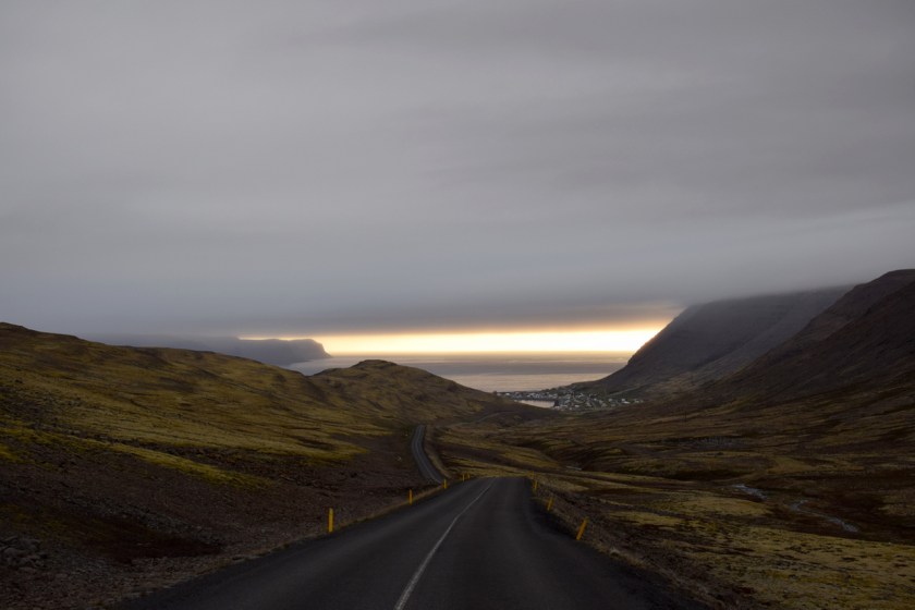
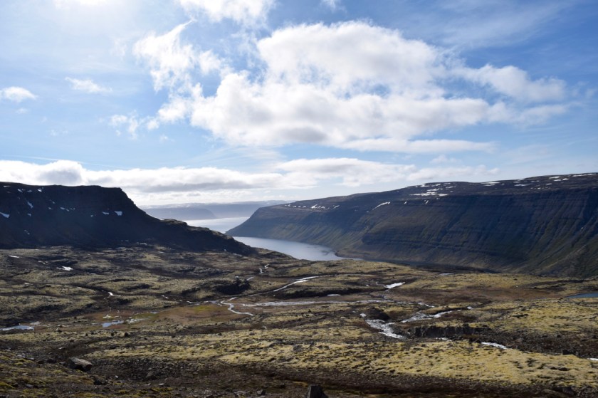
By the time I got back to paved road near Bildudalur, the clouds were coming in from the Atlantic. It was getting kinda windy too. Not good, not good.
I stopped in Talknafjordur for a shower and swim, and then I got back out around 10pm, the clouds were gone. Awesome.
Looking at my map, I decided to camp out at the western-most point of Iceland, the bird cliff of Latrabjarg.

Driving out to Latrabjarg is an experience I would like to forget, but probably never will. The road was terrible, it was WINDY, and the clouds were back with full force.
About 10 kms in, I wanted to turn back, but I couldn’t. The road was very narrow and no guardrails off the edge of the cliff. Gah! Only way forward was ahead.
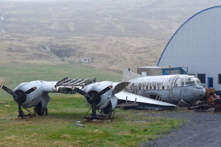
After about 15 kms of white-knuckled driving, I finally made it to a town that had one house and an abandoned US Army airplane. Kinda cool.
I could have turned back at this point and headed back to the main highway, but I wasn’t risking it through the cliffs again. I guess I was camping out there tonight 100%.
The drive out to Latrabjarg was turning out to be more than I had bargained for. It was around midnight, and I was driving into what looked like oblivion. There was also no real spot for me to setup my tent.
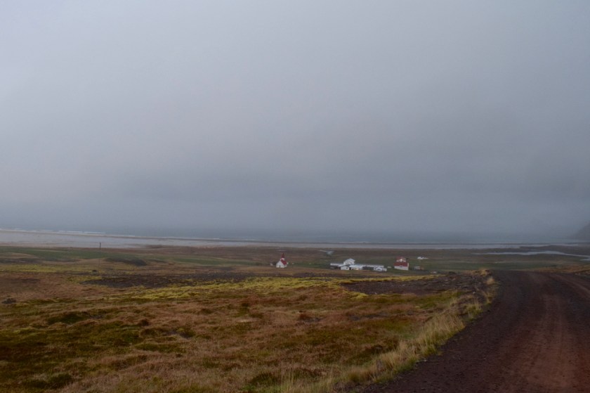
I finally got to the town of Breidavik, which was at a lower altitude. I was gonna stay here tonight. Latrabjarg, which was still another 12kms away, would have to wait till tomorrow. The visibility was so bad up there anyway, I wouldn’t have been able to see a thing.
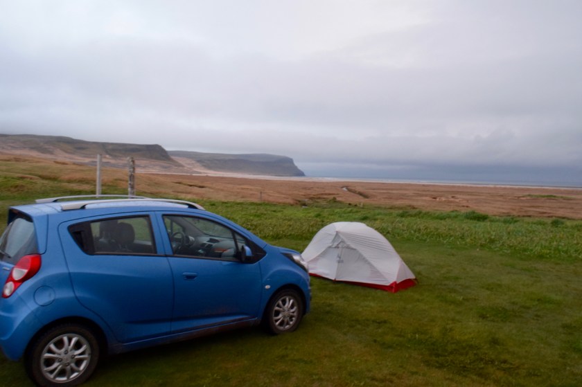
Not that I cared at this point. I just wanted to go to bed. I set up my tent in the middle of a grassy patch in town. There was a weird soggy mist that had surrounded the whole area and a lot of wind.
I fell asleep wishing I could teleport back to Isafjordur.

It does look magical…and sea monsters😳.
LikeLiked by 1 person
Your photography skills amaze me. Its hard to believe you taught yourself. Two thumbs up!
LikeLike